Recently I also made a concept how a Svalbard map could look like:
The best match for the Torii Gate in the game is undoubtedly the Fushimi Inari Shrine in Kyoto, not the Itsukushima Shrine in Hiroshima!
1 Like
Missing Greenland, Iceland, the Urals (which can be added with a Baltic dlc with Poland and Denmark), Persia, Siam, South China (which can be added in an Asian dlc), South Africa (which can be added with a dlc with Kongo and Shona or Zulu) and Oceania and Pacific Ocean (which can be added in another dlc with Maoris and Hawaiians, Australia would be a new Dutch and British revolution)…
That’s cool. Great work.
Your map matches the game maps and it shows how the devs completely messed up the placements of some of the North American maps. They made the borders for Florida, Carolina and New England way too far north, and Plymouth is in completely the wrong spot - they’ve got it up in Nova Scotia.
ty ![]()
but the placement of north american maps is not their fault ^^ since the base map from 2005 is wrong on purpose. it was made this way to represent inacurate maps from the eraly times of exploration

9 Likes
I don’t know about that. The map is distorted for that reason, but I don’t think historical explorers and cartographers would have simultaneously known to draw Nova Scotia and also thought the Plymouth colony was there. The placements of borders should be roughly in the right spot in regards to major land formations, even if the the coastlines aren’t quite the right shape.
The map has the Dakotas pressed up against Hudson Bay and presents the Great Plains - the largest, single geographical feature of North America - into a tiny section in the center of the continent.
Accurate, it is not.
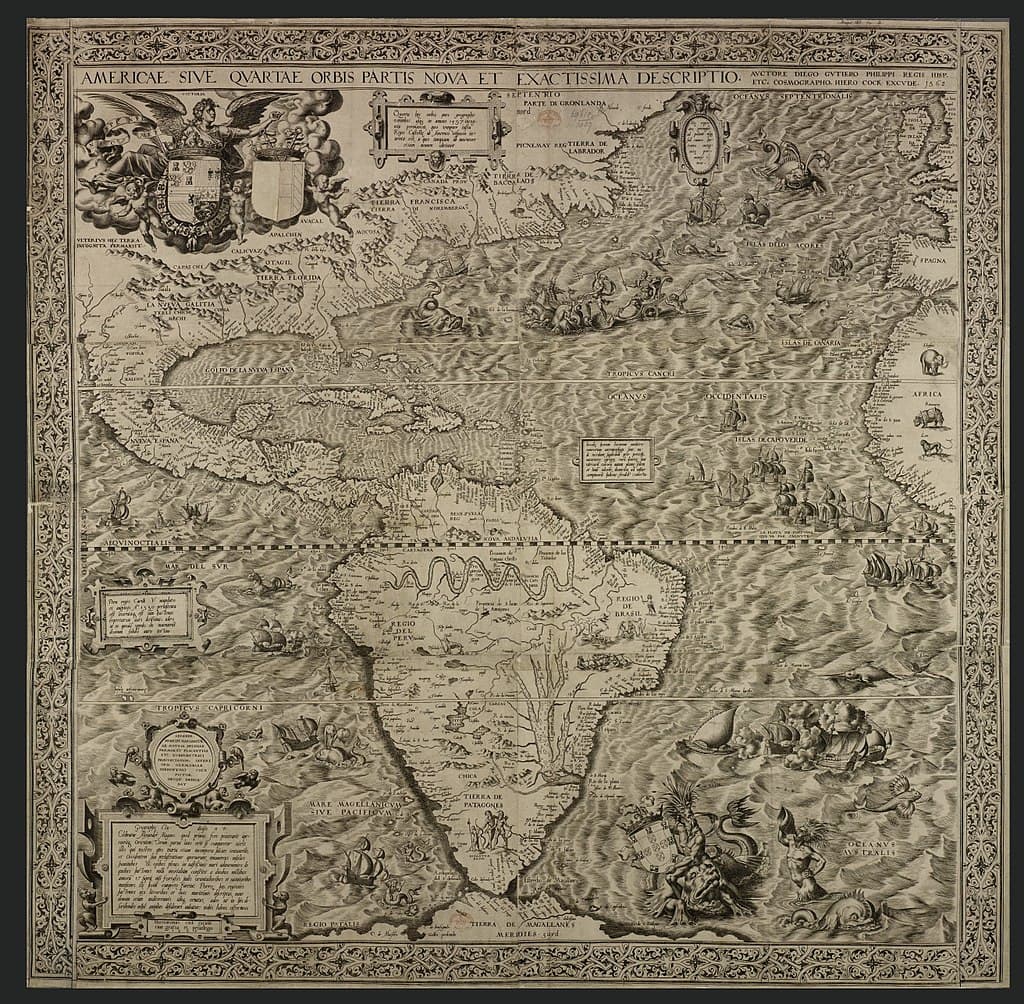

But as you can see, even though the maps are distorted, they still knew certain major land formations and where places were in relation to those. They wouldn’t have got a map wrong the way the game does. The coastline of the game maps is fine - it’s the borders of the regions that make no sense.
1 Like
Yeah, its basically a giant game of telephone, that created this mess ![]()
real map → og devs make inacurate/oversimplified map → warchief expansion adds new maps → (…)
→ DE devs try to make sense of original map and need to find fitting locations for esoc maps + new ones → (…)
→ i try to make it a realistic map again
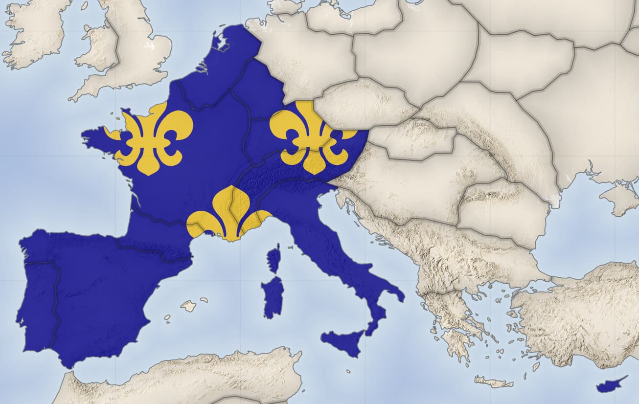
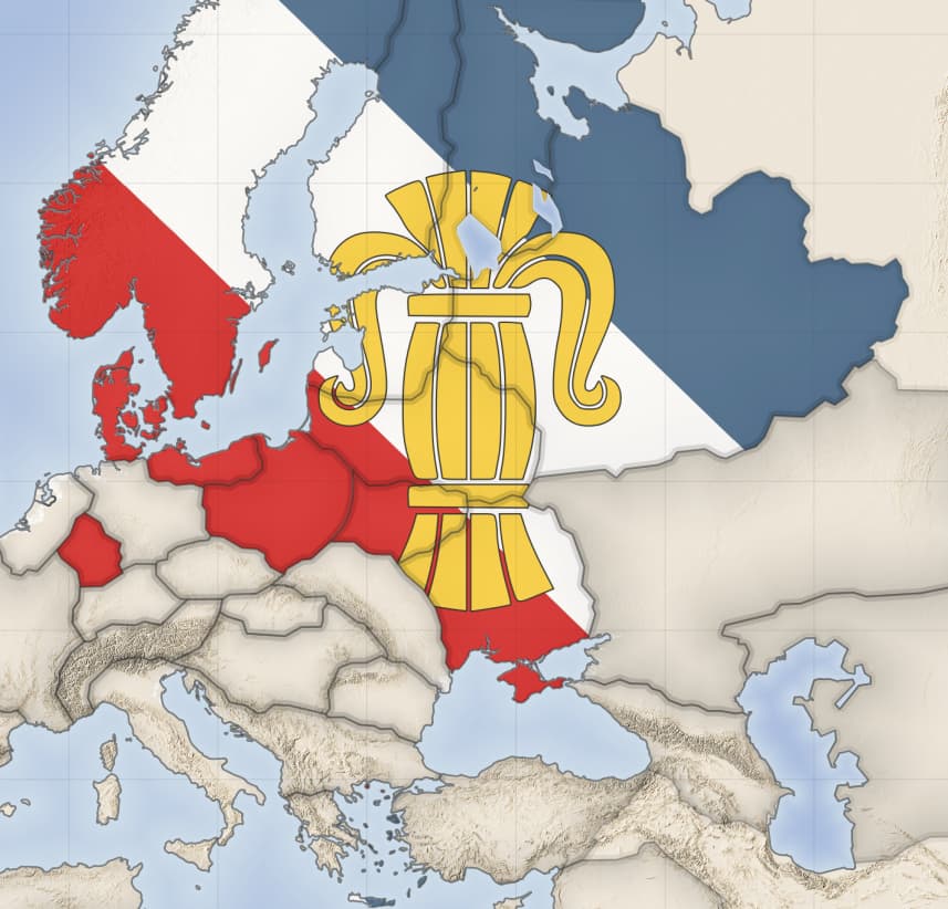
Distribution of european royal houses
Bourbon:
Habsburg:

Hanover:

Jagiellon:

Oldenburg:

Phanar:

Vasa:
Wettin:

Wittelsbach:

let me know if u find mistakes ^^.
Information is mostly from the fandom wiki - unfortunately there were some errors on the wiki, hope i found them all
18 Likes
Great effort - looks awesome!
3 Likes
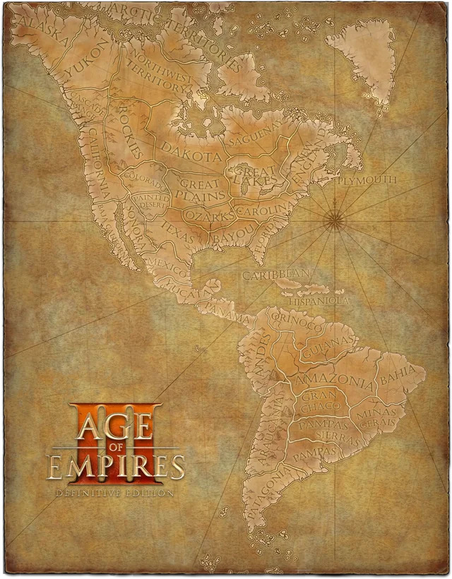
Someone makes the America full version in reddit.
https://www.reddit.com/r/aoe3/comments/178xw0v/big_map_of_the_americas_patched_together_from/
5 Likes
You did it before, didnt you?? I mean, its literally the 1st comment in this post.
It’s good to print and hang on the wall xd…
3 Likes
The earlier post doesn’t have all the newer maps.
3 Likes
Which ones?? I cant tell the difference
Plymouth is next to the Cape Cod peninsula which you can see on the Carolina map. Dakota should be nowhere near Hudson’s Bay. Pampas Sierras is pretty questionable.
All the South American maps are very off where they should be. But since maps in South America are super scarce as they are, it’s better to not think too hard about it.
1 Like
It is because it is a map from the 18th century, obviously the maps are not going to be exact like modern ones…they may have geographical errors from the time…