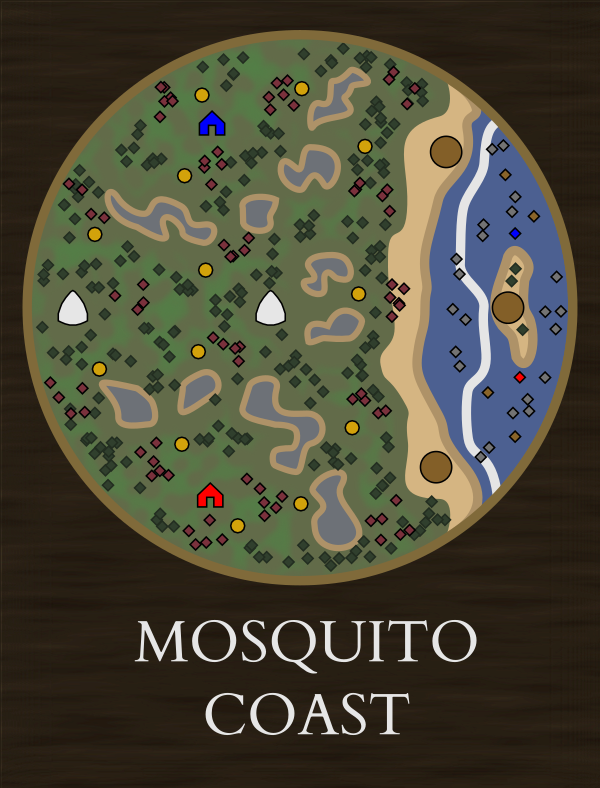
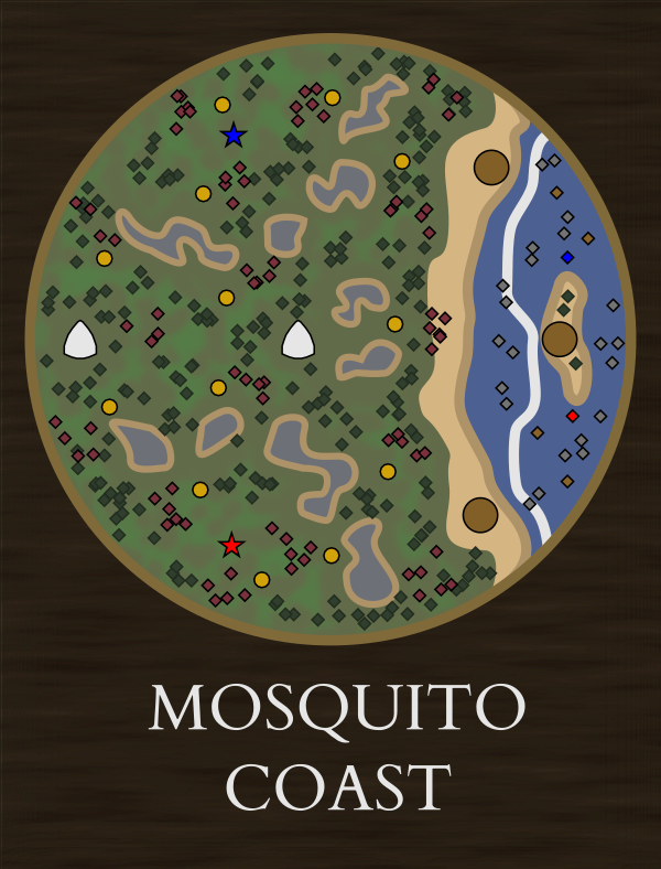
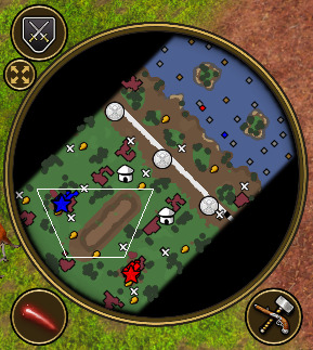
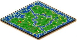
The Mosquito Coast is about as harsh as it sounds. Swampy terrain that can’t be built on surrounds your starting location and pirates guard their smuggling routes along the coast. Dense forests and hostile treasures fill the interior.
Settlements - Maya, Zapotec, Maroons Trade Route - Capturable but guarded by pirates. The island tradepost could even be guarded by a ship.
A LOST version of this map would be an excellent historical reference to the tragedy of the Poyais Scheme. Many treasures of trapped settlers could portray the doomed colonists.
I like it. VERY MUCH. I personally think Bahia should’ve been this one @vitorcxb20 . It’s much more suitable than the one chosen from ESO repository. Let me kidnap your idea Mozilla.
Why update Bahia and Pernambuco?
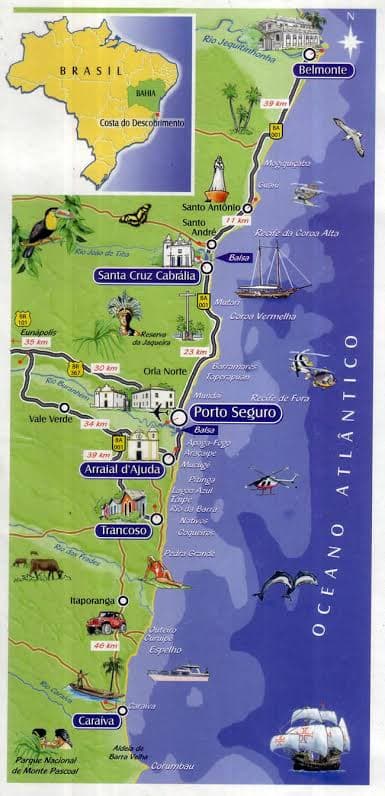
If this map is chosen to replace the current Bahia map, the only modification would be the pirates protecting the Trading posts and water puddles in land. Bahia was a coastal region when “discovered” by the Portuguese in 1500s. They only went inwards for real after several decades/centuries just like in USA.
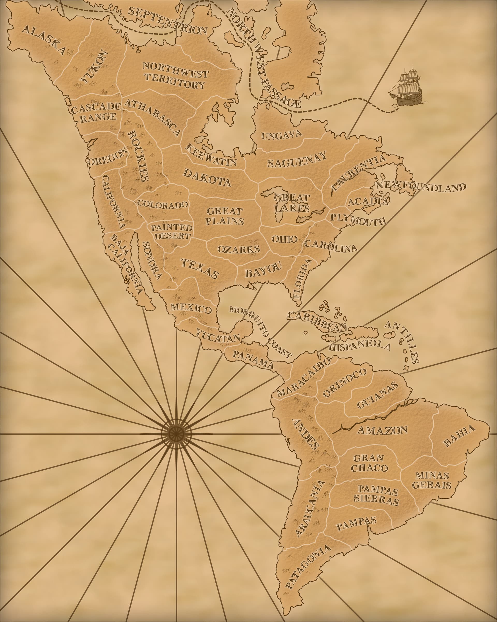
The current one (Lumaco) could be used to create “Pernambuco” or Northeast Brazilian coast: the region above Bahia - look at the first map I posted above.
Doing a geographical comparison
Pernambuco and the northeast coast stretches horizontally, with much more interior land proportion than water. They have a small rotation NE (just like Lumaco).
Bahia stretches vertically with more water proportion than land (unlike Lumaco). Just like Mosquito.
Why are Pernambuco and Bahia unique?
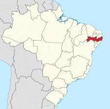
The region above Bahia was later known for the Dutch colonization as New Dutch/Dutch Brazil and their governor Maurice of Nassau (yep, the same one from the game) around 1630 . The capital was Pernambuco/Recife. So, as you can see these two regions are QUITE apart until late 17th- early 18th century. AOE3 generalized all of the right side of Brazil has been generalized as “Bahia”, but we can fix that.
IMAGES
Pernambuco highlighted above Bahia
AOE3 Bahia/ Lumaco
I think this map is blessing! It looks good, there can be one more South America map and it’s a much more suitable and geographical representation. Even the key naval colonial commerce route to the east is also represented by both maps!
The reason I picked the Mosquito Coast was to support my suggestion for getting the Maya and Zapotec out of South America by giving them another map to reside on instead.
Being a LOST map that is a reference to the fictional country Poyais would add some interesting history while also giving a water map to the game mode.
You’ll get endorsements from all the Brazilians. The moment I looked at your map I thought of Bahia. The one we have has nothing to do with it.
For real: Yes, I do agree with you that there was not much focus on arranging Central and South America and I think it’s great you are dedicating yourself to that.
You have talent friend. I remember your artic maps!
I have ideas for Cuba: a much more rounded Borneo with much smaller water strips .
I’m also trying to figure it out how a good Black Forest map would be: I’d use a portion of the Amazon region.
Much appreciated.
I know people ask a lot of things every day to you devs, but this one map felt like it came from Heaven correct the representation: Mosquito feels like a blueprint of Bahia and Lumaco feels like a blueprint of Pernambuco.
An Amazon Inner map with a maze of dense forests would be awesome. The Cuba you’re describing sounds too similar to Borneo and Hispaniola though.
For South America, the Caatinga biome and Atacama desert could probably be squeezed in. I also made a space for a Maracaibo map that could fit Muisca and Jivaro natives but I’m still trying to figure out a good layout for that one.
Yep. It’s like the map “continental” of age of empires 2. It’s almost the same as Borneo but more rounded, almost like a circle and with water being much less present.
It would be played as a land map, since you couldn’t go farther into the ocean:
Anyway enough other maps. Let’s keep talking about Mosquito!
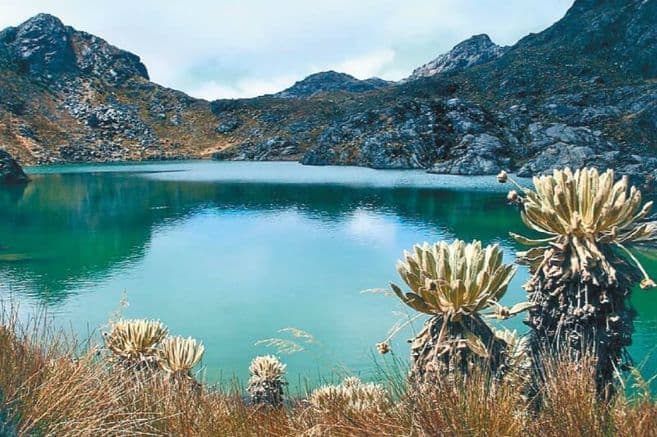
It would be a combination of the rocky map and parallel rivers. In the higher parts there would be rivers or lakes with crystalline or blue water. While in the middle a river in a canyon with murky waters and a lot of fishing for the yellow river ethyl.
Here we all live with the hype through the roof and that is why the forum never stops receiving ideas. I hope that eventually many of our petitions will materialize.