New Maps with Riverine Trade Routes

The great rivers of North America were the arteries of trade linking to the resources of the interior. These regions could be represented by new maps to expand the concept of water trade routes beyond just sailing ships off the coasts of Africa. The Voyageurs were the facilitators of this trade, and the appearance of these routes should reflect that. The routes should progress as follows:

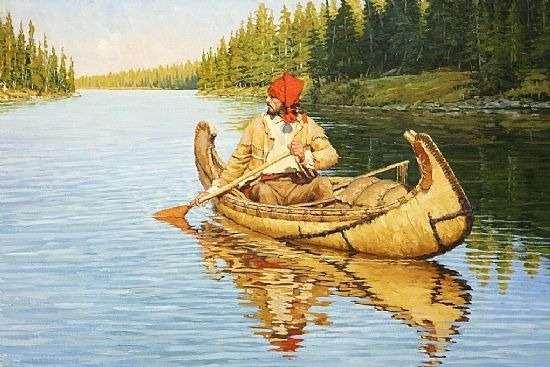
  1. A Small Canoe with only one or two trappers/natives

image

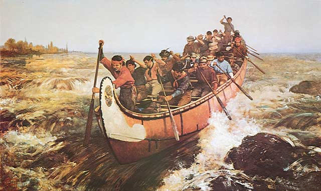
  1. A Large Dugout Canoe with many Voyageurs
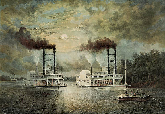
image

  1. A Paddle Steamer

image

A similar style of trade route could also be implemented in other regions with different styles of the smaller riverboats/canoes.

New Maps

New maps like Laurentia, Ohio, and Oregon shown below could accommodate riverine trade routes. More potential maps like Athabasca, or Newfoundland could expand the concept even further. These maps could also expand the representation of underused natives like Huron, Cherokee, and Klamath.
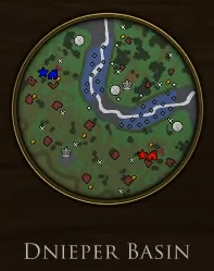
Laurentia

Settlements - Huron

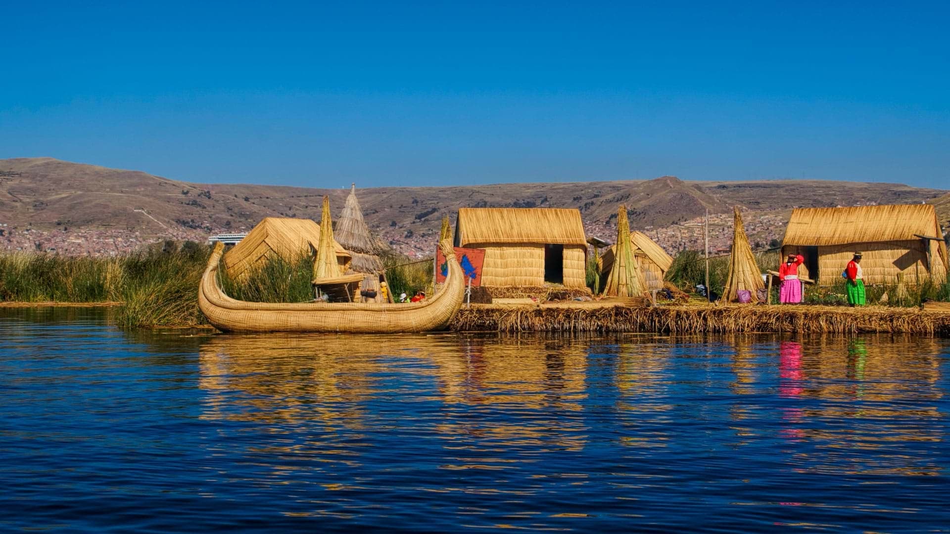
Description - The St. Lawrence river is the gateway to the great lakes and a bustling hub of trade. This map combines the best features of Amazonia and Orinoco with a land choke point for crossing to the opponent’s side without ships, but also access to the water to bypass getting bogged down in the narrow crossing.
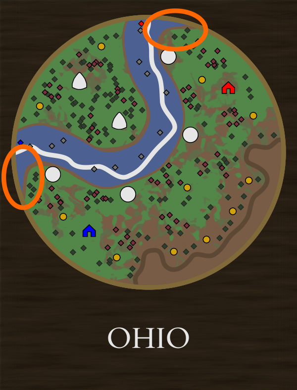
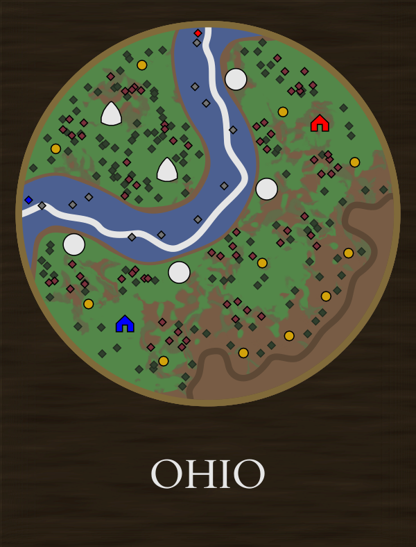
Ohio

Settlements - Cherokee

Description - The settlement of the Ohio river valley was originally forbidden, but the relentless expansion of American settlers into its fertile lands removed it from the dominion of the Natives and French. This map features a moderately sized river with no shallow crossings with dense woods and Cherokee settlements on the far side. Abundant sources of coal and metals can be found in the mines along the Appalachian foothills.
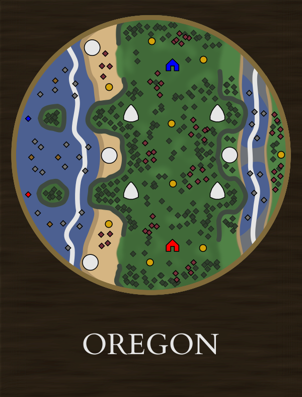
Oregon

Settlements - Nootka, Klamath

Description - Temperate rainforests cover the coastal ranges of the Pacific Northwest. Salmon runs fill the rivers with plenty of food. A rocky coastline makes control of the sea necessary for trade and creates water chokepoints. The main plateau is home to many native settlements, but flanking is possible through the river valley on the fringes. Players could possibly start with a canoe on this map to help with water crossings and establishing trade.

Locations and Other Maps

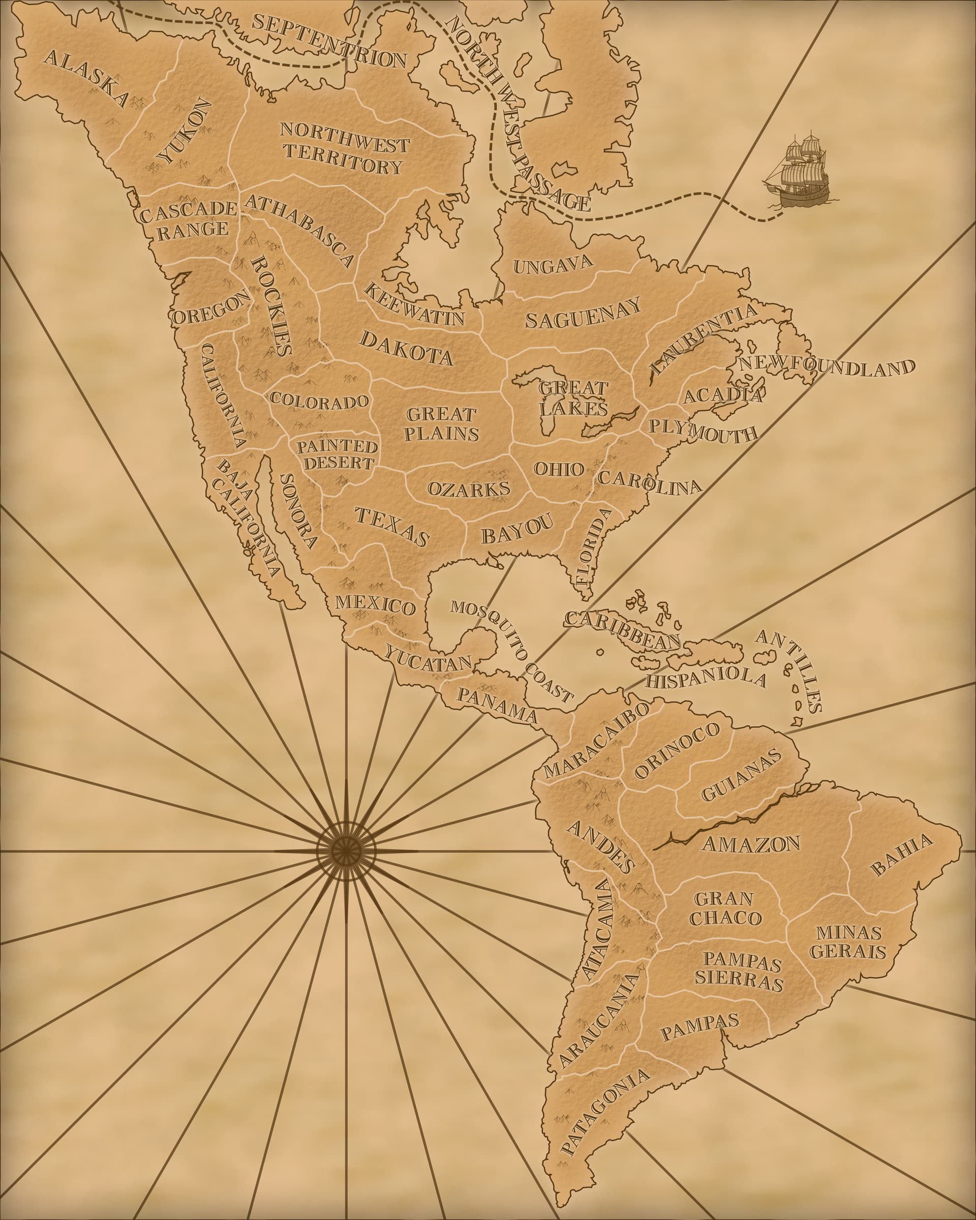
To better fit Laurentia and fix inconsistencies, Plymouth should be shifted to actually include the area with Plymouth, and also have Cherokee settlements. New England should then be renamed to Acadia, and Cherokee settlements removed from that map.

Athabasca and Newfoundland could accommodate even more riverine trade routes.

Ungava, Keewatin, and Northwest Passage:

Mosquito Coast:

Antilles:

24 Likes

I would totally play this maps!

5 Likes

Beautiful maps, they look like a lot of fun.

One thing I’ll add: I noticed that the developers create new maps to highlight the home area of a civilization which they are working on. In this case, the Inca touch-up added new South America maps, the Aztec touch-up got a few maps for Central and northern South America, and the African civs got a ton of brand-new maps reflected North, West, and East Africa. However, the United States was not accompanied by any new maps, and nor was Mexico, so I think it is time to revisit North America and make more new maps for both civs!

3 Likes

The Aztec touch up and new Panama map were kind of preparation for the launch of Mexico. But USA was completely lacking any new maps so these could fill that role.

2 Likes

Of course, but these were touch-ups of preexisting maps, whereas I and the rest of the community are always interested in getting brand new maps into the game.

2 Likes

Optimizing the old maps is always welcome. On that note, would you consider changing some terrain types such as allowing small boats to cross shallow water?

Maps like Northwest Territories and Nile Valley (and the Oregon one I’m proposing) don’t really live up to their potential when you need to make multiple docks to access only tiny amounts of resources.

Also, the location of the Plymouth map not actually including Plymouth kinda irks me (and rearranging that region could make room for Laurentia).

1 Like

I absolutely love your map concepts. I always try to envision a good map but I can get my brain to work.

Even though NA is crowded I’m sure those concepts could be used to Asia, Africa and Latin America. I personally enjoy Ohio and Oregon. I wonder if the first map could have another shallow path.

Yep. I’ve always thought about that when you started to make Latin America maps to compensate their emptiness.

However, there are NA minor natives who are present only in a small amount of maps (e.g.: Cherokee ~4 maps), so imo expanding their area into more maps would make sense in a near future, eventually.

2 Likes

Similarly the Plata and Amazon rivers were, and still are, major trade hubs that also could use some new maps with riverine trade routes. Hell, you can make this argument for basically any river that ever existed.

5 Likes

Yep.

Laurentia is immediately a better implementation of the concepts used for Amazon River and when I saw Ohio I immediately thought of “Rio da Plata”.

Asia is also a big region that deserves more maps.

4 Likes

In my opinion, my Laurentia design would be a better fit for Rio de la Plata than Ohio. I went with North America because I wanted to justify some big Voyageur canoes and steamboats and the natives in the regions I picked were underused (if they are more common the chance of some improvements to them would be better). I also wanted to get a sliver of the Appalachians into the Ohio map too.

1 Like

I really like maps that contain lakes and rivers.

Lake Titicaca could be one:


1 Like

Don’t forget Asia where maps are truely lacking with out-of-place natives…

1 Like

???

20 char for questions marks

Never mind. I was trying to reply to a previous comment.

I fully agree. I wouldn’t mind seeing this map design used for both Rio de la Plata and the St. Lawrence river, just replace the north american natives and biome with south american ones.

1 Like

I was leaning more towards the Atacama region for another South America map but Titicaca could also be an option.

It’s got me wondering why they opted to give the Inca a navy with only one type of ship. A smaller reed boat like what is used on the lake would really help round out their navy. It seems like quite a glaring omission and makes their navy pretty boring.

3 Likes

Some of them are kind of obvious like combining Amazonia and Orinoco into Laurentia (I didn’t add a second crossing because I wanted to preserve the chokepoint and make players go for a navy to get around it and avoid the stalemate that happens on Orinoco). Ohio is slightly inspired by danil92’s Chupat map but it took me a couple of tries to perfect what I wanted to do with it. Oregon took me quite a few rough sketches before I settled on that design. Looking at the geography and pictures of the areas also helps with the inspiration and trying to design around one core feature like water trade routes also helps.

I’ve got a couple of ideas for some Asian and South American ones and maybe even some for Oceania. I think northern Africa is adequately represented now and southern Africa probably needs a full expansion into that area for any realistic maps for there.

This was a big motivation. Huron, Cherokee, and Klamath are all on only 4 maps. I’d like to see some more improvements to those natives and greater usage of them makes it more likely. Stuff like your idea for a Nootka tech that sends a whale would be awesome (and make waaay more sense than as a card for Mexico).

1 Like

I feel that giving a revamp to old maps sometimes is as good as a brand new map.

The reworked done by Vividly to Texas made it go from nothing to “standard”, so it’s always like a new content when the old concept is redone to the point of changing our perception and value of it.

Imo: 2 new maps + 2 reworked maps >> 4 new maps.

Even so, it’s not easy doing a good design and to top it off a viable implementation so as I had said, you are good on that. Perhaps if I start drawing the technique will come up too. :sweat_smile:

Thanks! :fist_right:t2: :fist_left:t2:

I can only appreciate the response because I had edited those very confusing techs to be more simple with your feedback.

Images of voyageurs, coureur des bois, and other pioneers canoeing through the rivers of the beautiful northeast wilderness brings peace to my heart.

Love both the setting and map design. Right up my alley. Great work as usual, Moozilla.

3 Likes

Looks like you got a little inspired by some of these.

Screenshot (121)

With this layout, I was designing things with an impassable river in mind. The problem with a relatively thin river with no land crossings is that docks could be constantly destroyed before ever being created (This could potentially be an issue on Budapest). My solution to that was to have the river bend along the edges (circled in orange) to give enough room to build docks that could be concealed by the fog of war. Achieving that might take a slightly wider river than my depiction, but it would still look similar. That shape also has the benefit of looking really good which is a nice bonus. The new Dnieper Basin map has the same aesthetically pleasing look but it doesn’t really take full advantage of how this can minimize the width of an impassable river that can be fully traversed by ships.

Screenshot (142)

Hopefully, some of these new map features like naval trade routes eventually make it to the older regions that lack them.

5 Likes