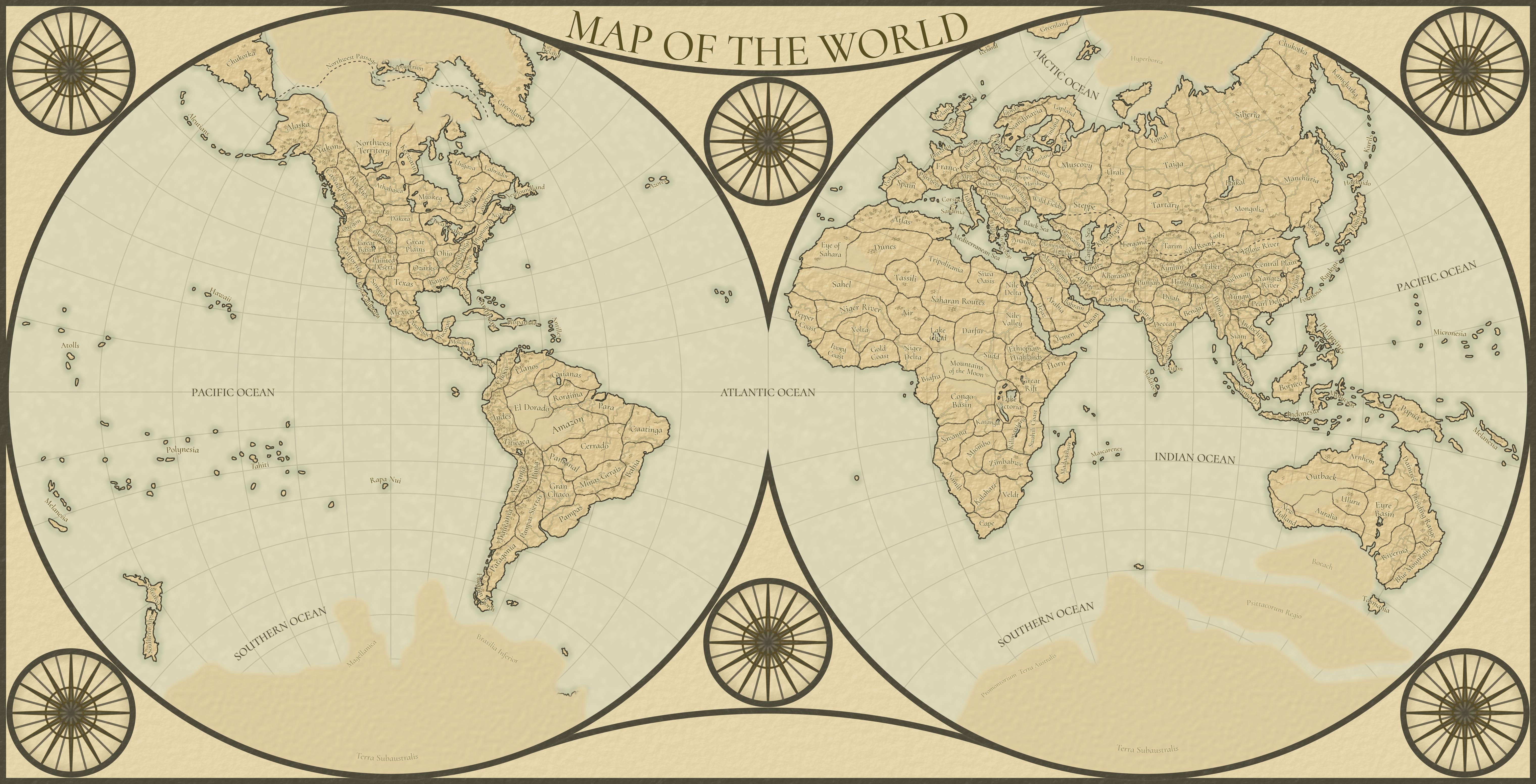
New World Map
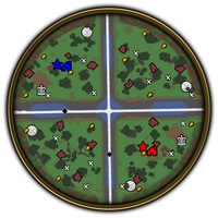
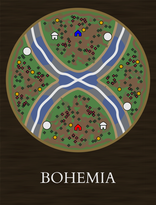
Below is my compilation of maps that I believe should be added to the game. This fills out the missing regions of the map and presents them in an aesthetically pleasing way that could be easier to navigate than the selection menu in game. My aim was to fix the many inaccuracies of the current loading screen maps and strike a balance of being reasonably accurate but not perfect, and still having some unexplored regions that the “Unknown” maps can fit into. Regions that do not yet have maps could simply be covered by the unknown regions until they are ready to be added. This style would also lend itself well to a world conquest game mode as you could see the world as you conquer.
Reference Maps
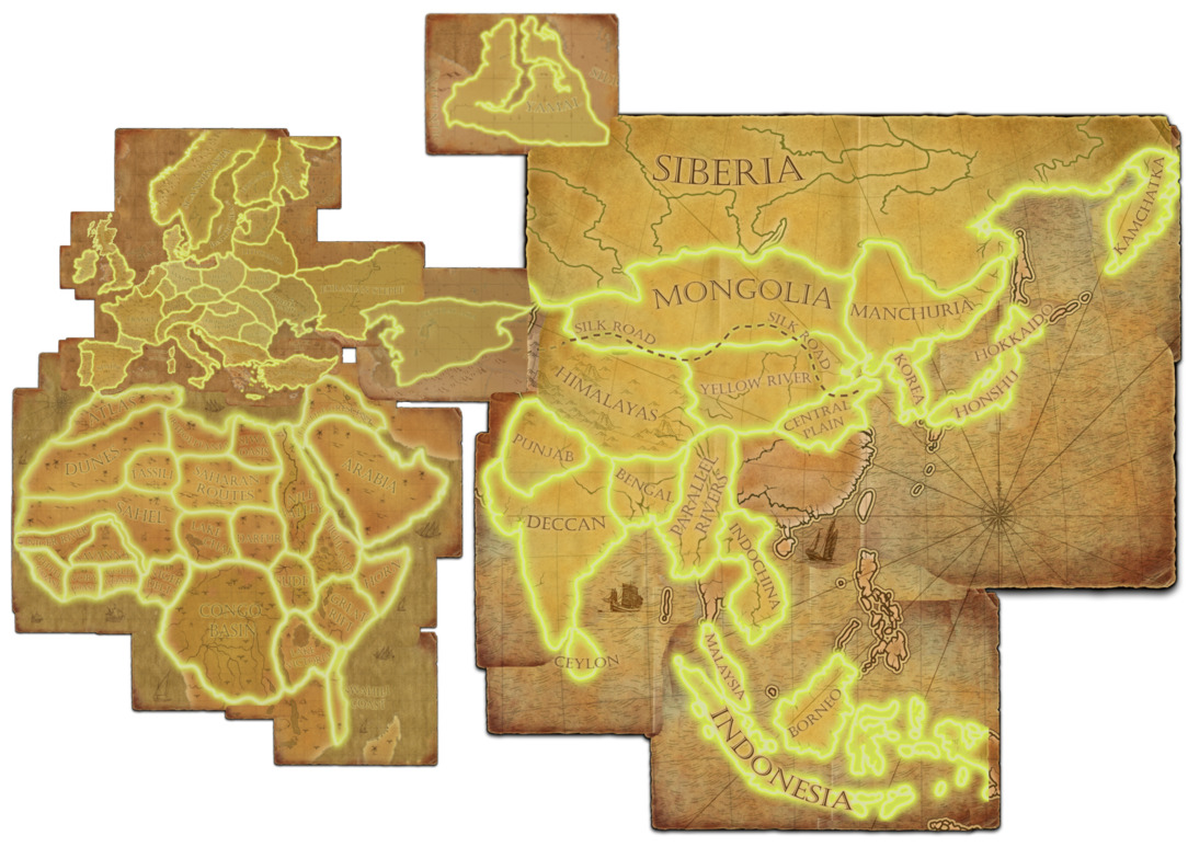
Renamed Maps
Some name changes are to fix excessively generic names (Central Asia, Parallel Rivers, etc), some are to better reflect map locations (New England containing Plymouth), and some are to make the names more concise so they actually fit on the big map (the European have a lot of very long names for very small territories).
Americas
New England → Acadia (the New England region is already covered by Plymouth)
Arctic Territories → Septentrion
Orinoco → Llanos
Africa
Savanna → Volta (Savanna name reused in southern Africa)
Highlands → Ethiopian Highlands (to differentiate from Armenian Highlands)
Asia
Parallel Rivers → Burma
Fertile Crescent → Mesopotamia (the rest is split into Levant)
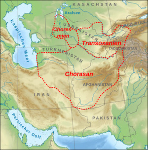
Central Asia → Khwarazm
Europe
Dnieper Basin → Wild Fields
Vistula Basin → Poland
Hungarian Plains → Pannonia
Eurasian Steppe → Steppe
Karelian Lakes → Karelia
Balkan Mountains → Balkans
Acropolis → Hellas
Wallachia → Danubia
Black Forest → Removed from Europe (a more densely forested area like the Amazon, Congo, or Taiga would be a better fit for a map like this)
New Maps
Below is the list of all I think I should be added. I tried to make everything fit nicely in this form, so I don’t think trying to cram any more into Europe is a good idea, but there are probably a few more that could be slotted in or renamed, especially with the mess that is the current maps of South America. I’ve already done a few mini-map designs, and I have some ideas for lots of these in the list so I might post them as I make them. Hopefully there’s still someone who can add new maps with Vividly gone from development.
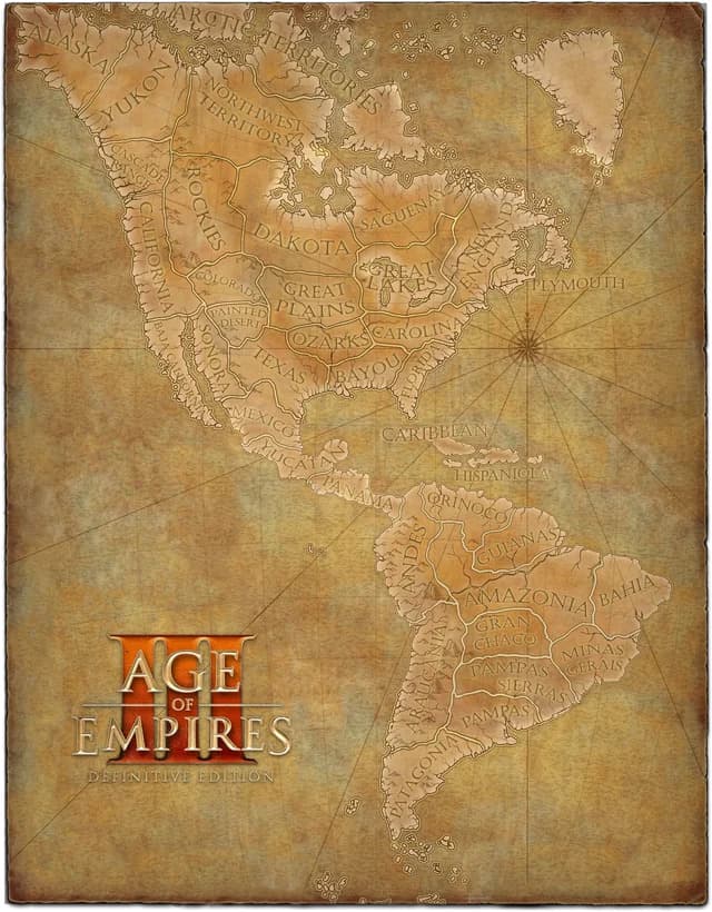
North America
Aleutians
Greenland
Athabasca
Northwest Passage
Ungava
Keewatin
Muskeg
Labrador
Newfoundland
Laurentia
Oregon
Ohio
Great Basin
Appalachia
Anahuac
Mosquito Coast
Antilles
South America
Choco
El Dorado
Roraima
Para
Caatinga
Cerrado
Pantanal
Puna
Atacama
Titicaca
Fuegian Fjords
Europe
Brittany
Fjords
Lapland
Azores
Iceland
Africa
Air
Nile Delta
Biafra
Mountains of the Moon
Savanna (original map renamed to Volta)
Katanga
Kilimanjaro
Namib
Miombo
Zimbabwe
Cape
Kalahari
Veldt
Madagascar
Mascarenes
Asia
Armenian Highlands
Levant
Hejaz
Yemen
Oman
Bahrain
Zagros
Elburz
Fergana
Khorasan
Balochistan
Gujarat
Malabar
Maldives
Coromandel
Doab
Kunlun
Tibet
Tarim
Gobi
Yangtze River
Yungui
Sichuan
Pearl Delta
Fujian
Formosa
Ryukyu
Sakhalin
Kurils
Urals
Taiga
Baikal
Tartary
Chukotka
Siam
Sumatra
Philippines
Moluccas
Oceania
Papua
Micronesia
Melanesia
Tahiti
Atolls
Hawaii
Polynesia
Rapa Nui
Aotearoa
Southern Alps
Arnhem
Outback
New Holland
Auralia
Uluru
Eyre Basin
Daintree
Dividing Range
Blue Mountains
Riverina
Tasmania